
Walk 13: The Ascension

I’m often asked how I plan the routes for Walk Tonbridge and where I decide to go next. The short answer is I’m guided by the map.
Interesting features make for an interesting walk. Rivers, lakes and woods are all easy to spot, as are the all important pub stops. A quirky place name or church catches my attention, but above all else I’m led by the paths available to me.
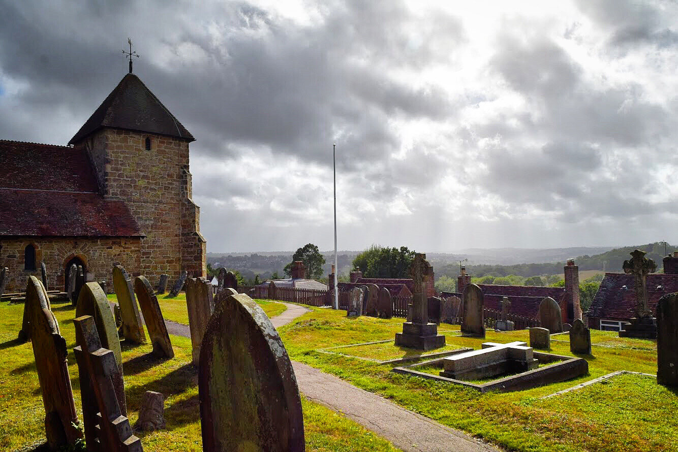
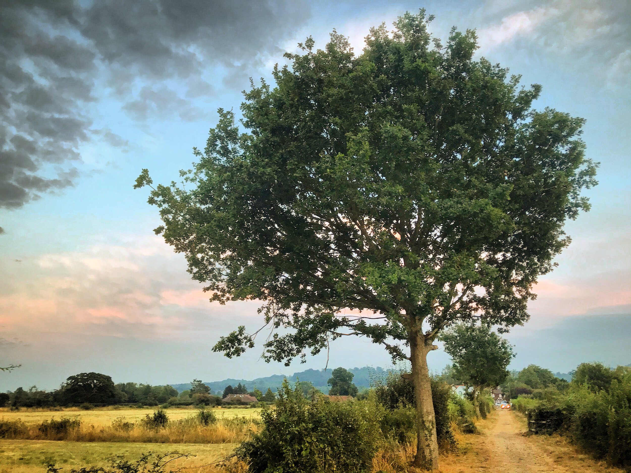
The route up to Bidborough was one that I was particularly excited about. It’s tightly condensed contours hinted at the promise of jaw dropping views and the satisfying feeling of walking up the scenic ridge, that I had previously only ever driven to (normally finding myself in the company of other sunset hunters upon arrival).
The map delivered on both accounts but what it hadn’t prepared me for was the beauty of the parts of Bidborough I had not explored previously. The little black square and cross, had told me there was a church here, but had not given any indication of the prettiness of the churchyard and its enchanting vista. Nor had it been able to convey the magic of walking downhill through narrow tracks of barley as the last rays of sunset illuminated the town below.
Summer is cooling off and the nights are drawing in quicker than ever, but its still moments of discovery and wonder like these that continue to be the dynamo behind the walks, powering me on to keep coming back for more.
Thank you to everyone that has walked this journey with me - I am not sure when or where it will end, but there are still a few green dashes left on my map that I’m keen to explore.
Begin your walk at Haysden Water car park - this is approximately 1/2 mile from the main car park at Haysden Country Park, located near the sailing club.
Turn right and follow Lower Haysden lane for 450 metres. This is normally a quiet stretch of road, but please walk with care.

Lower Haysden Lane, Tonbridge
After a short while you will reach Great Haysden cottages. The house behind these was once the site of an old brick works.
The origins of Tonbridge's recent brick making history coincide with the Victorian era and the industrial revolution. When the railway arrived in 1842 it brought with it a population boom, as a new town began to spring up South of the river.

Great Haysden Cottages, Haysden
One shrewd investor had seen this opportunity coming and took a punt, buying up some farm land near Quarry Hill several years earlier. Priory Farm had been put up for sale by James Alexander, a ridiculously wealthy merchant banker that had made his fortune in India before going on to buy Somerhill. Upon his death in 1848 Somerhill was bought by The Goldsmid family and much of the farm was snapped up by Mr Edward Punnet, a local builder.
Punnet had begun his career working as a stone mason, but then went on to master the art of plastering, bricklaying and tiling. Upping his skill set further he ventured into brick and tile making. He was a master builder by anyone’s standards.

Brickworks Close, Quarry Hill
With a new source of wealden clay at his disposal he established three brick fields in Tonbridge, roughly where Woodfield Road is today. The clay would have been dug locally before being mixed with sand and fired into bricks.
The family run company had built Waterloo Place and George Street, before accepting a commission to build nearby St Stephens in 1848. In the years that followed, the population of Tonbridge exploded. Between 1851-1891 it grew from 4000 residents to 10,000, and the towns brickyards were supplying the rampant house building taking place in the streets around the station and at the Slade.

St Stephens Church, Tonbridge
By 1890 the Punnets were employing over 300 staff and were recognised as the biggest brick makers in town. It was at this point that they finally began to develop the farmland they had bought all those years earlier, presumably having waited until their land reached maximum value for development. Punnet and sons built St Marys Road, Judd Road, Weald View Road, The Drive and Springwell Road - transforming Quarry Hill from farm land to a huge estate.
Tonbridge bricks were traditionally produced by hand, but by the time they opened their next yard at the top of Quarry Hill, production had been mechanised and the output was over 100,000 bricks a week, further fuelling the growth of South Tonbridge as developments spread to the Judd Ward (Douglas Road and Barden).
Judd Road, part of the Punnets Quarry Hill development
The technological advances put paid to all of the smaller brick works, with this one at Haysden disappearing around 1950. Punnet and sons continued long beyond this date, remaining in Tonbridge until the closure of the Quarry Hill site in 1990.
Although the kilns burnt out long ago, the legacy never did. Thousands of South Tonbridge residents live in a Punnet built house and St Stephens remains an integral part of the community. If you ever walk past St Stephens, you will spot the family graves just outside the entrance to the church.

The Punnet family graves, St Stephens Church, Tonbridge.
Continue past Great Haysden cottages and then follow the lane until you come to a gate. Go through the gate and follow the track through the field.
To your right you will see an embankment - this is the tail end of the flood defences that run all the way to the main barrier and beyond. In total the embankment runs for 1.3km, giving you a scale of threat which the Medway pose if left unchallenged.

The flood embankment with Great Haysden cottages in the background
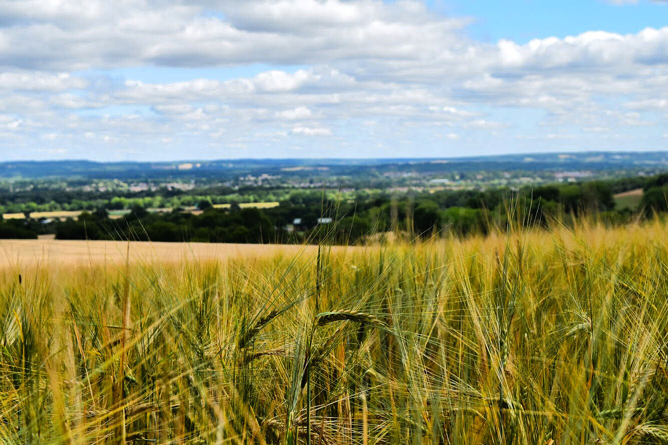
At the time of writing this, the field was being used to grow barley.
When it comes to crop farming in the UK - Barley is second only to wheat. An estimated 8 million tonnes were produced in 2019 and almost half of this was used for brewing. The next time you are enjoying a can or bottle of beer, check the ingredients and you will see that the malted barley features prominently. Hops add the all important flavour, but it is the barley doing all the hard work. If you think of it as a sandwich, then barley would be the bread and hops would be the filling.
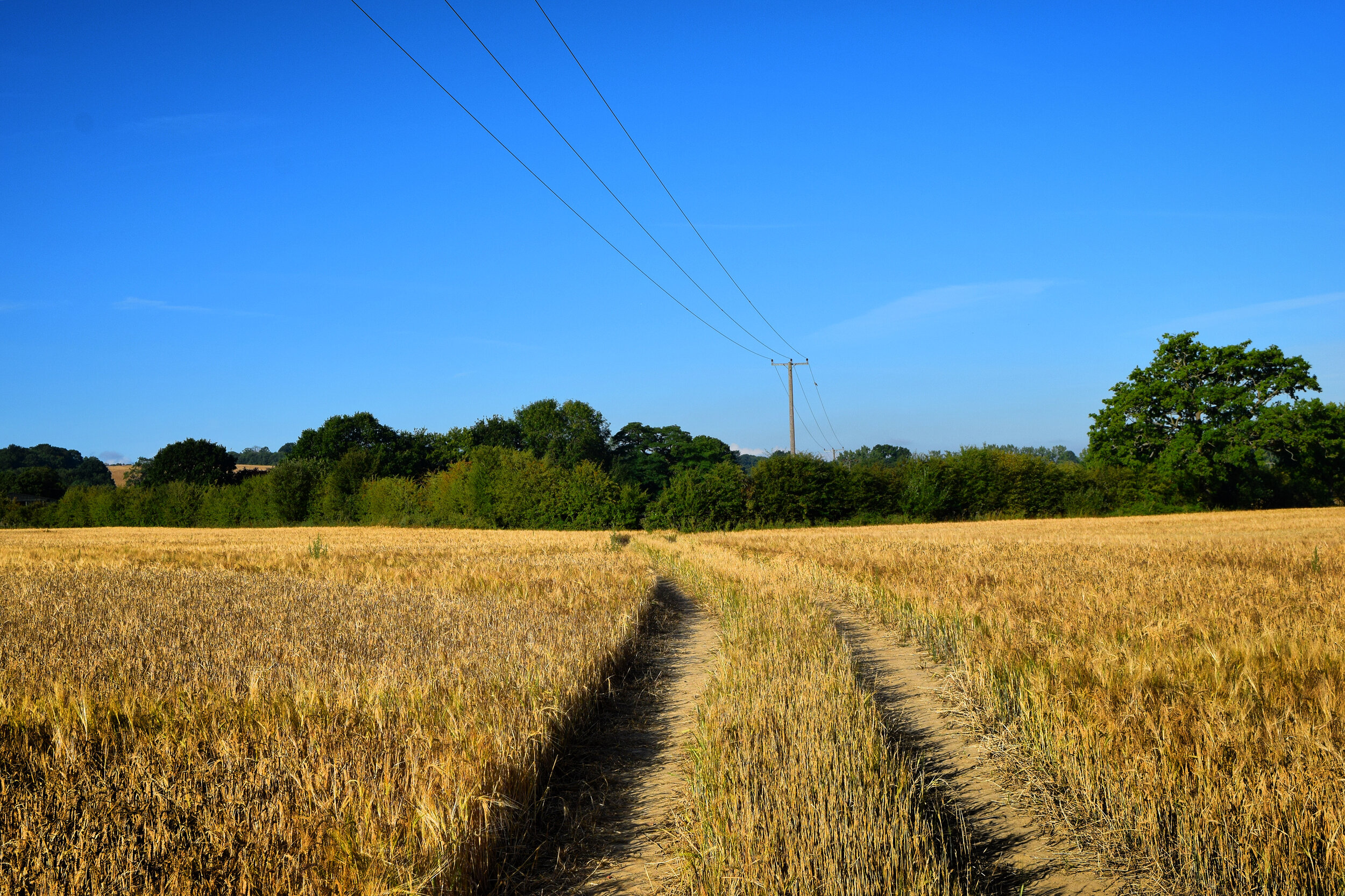
Making tracks through the Barley at Great Haysden Farm
As you reach the hedge, climb the stile and follow the path besides a paddock, before passing through a small metal gate as you pass through Great Hayesden farm.
The two different spellings for Haysden have been confusing Tonbridge residents for years, but seemingly not as much as the cartographers who are responsible for charting these.

Haysden - confusing cartographers since 1949!
At one point all the Haysdens (Haysden, Lower Haysden, Upper Haysden and Great Haysden) were spelt Haysden as in the country park that we know and love.
Perhaps it was a bad day at the office for the proof reader or maybe the cartographer had enjoyed a liquid lunch that day. Either way though it’s the 1950 edition of the OS map that the spellings start to go a bit awry.
By this point Brook Street Lane had been renamed 'Lower Hayesden Lane' and the extra 'e' had also crept into 'Haysden House', which was at the time charted as Hayesden House.
The confusion continued when a new boys school opened in 1964. The school amalgamated its name from the nearby roads Lower Hayesden and Brook Street - hence Hayesbrook school.

Great Hayesden Farm, Great Hayesden
As it stands today ' Lower Hayesden Lane' has been corrected to Lower Haysden Lane but 'Great Haysden Farm' is now listed as 'Great Hayesden Farm' and 'Hayesden House' is back to Haysden House. 'Upper Haysden Lane' as also been corrected, but a mile or so down the road it’s name reverts to 'Hayesden Lane'.
I live in hope for a united Haysden but until then it’s the delivery drivers I feel sorry for!

Old pumping station, near Fosters Farm, Haysden
After climbing another stile, walk across the driveway and on your right you will see an old Victorian pumping station, now a ‘grand design’ of a house.
Cross the field and then climb one more stile, continuing through the long grass. In the warmer months this unkempt meadow is alive with the sound of crickets. Their lively chirping makes a welcome distraction from the constant hum of the nearby A21.
Go through the metal kissing gate then turn left, continuing to the fence before climbing the stile. Continue with care and keep any dogs on a short lead as this field is home to some particularly curious horses - they will be quick to investigate any bags in the hope of finding food. Please do not feed them.
On your left you will see Fosters Farm. The farmhouse is obscured by modern barns and machinery, but its history can be traced back to back over 500 years, to when it originally fell under the ownership of the Manor of Bidborough. More recently it was owned by the Vizard family, who the sports pitches at Haysden are named after.

Walking through the long grass near Fosters Farm
Follow alongside the trees until you reach the far left corner of the field, at which point pass through the kissing gate and join the road.
Turn right and proceed with caution for 120 metres, before turning left into Gate Farm Road. After approximately 70 metres you will come to a gap in the hedge on your left. This is slightly overgrown, so keep your eyes peeled.
After passing through the hedgerow you will emerge into a large field, which forms part of the foothills of Bidborough Ridge. Take a deep breath and begin your climb as you follow the path uphill.

Climbing up into Bidborough…
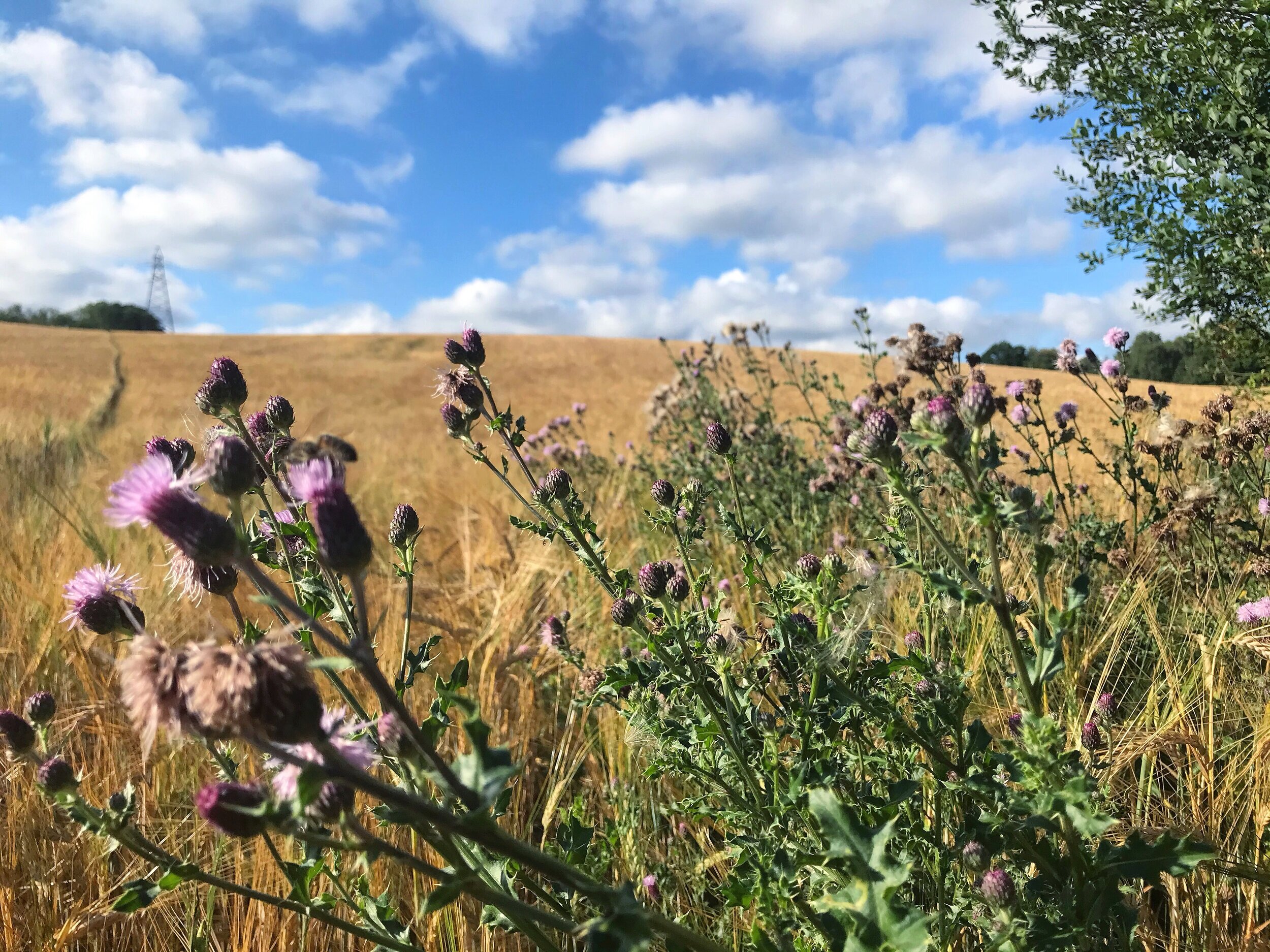
Continue along the path and you will pass a cluster of trees, blackberry bushes and thistles, forming an island in this huge field. This green oasis is a haven for wildlife.
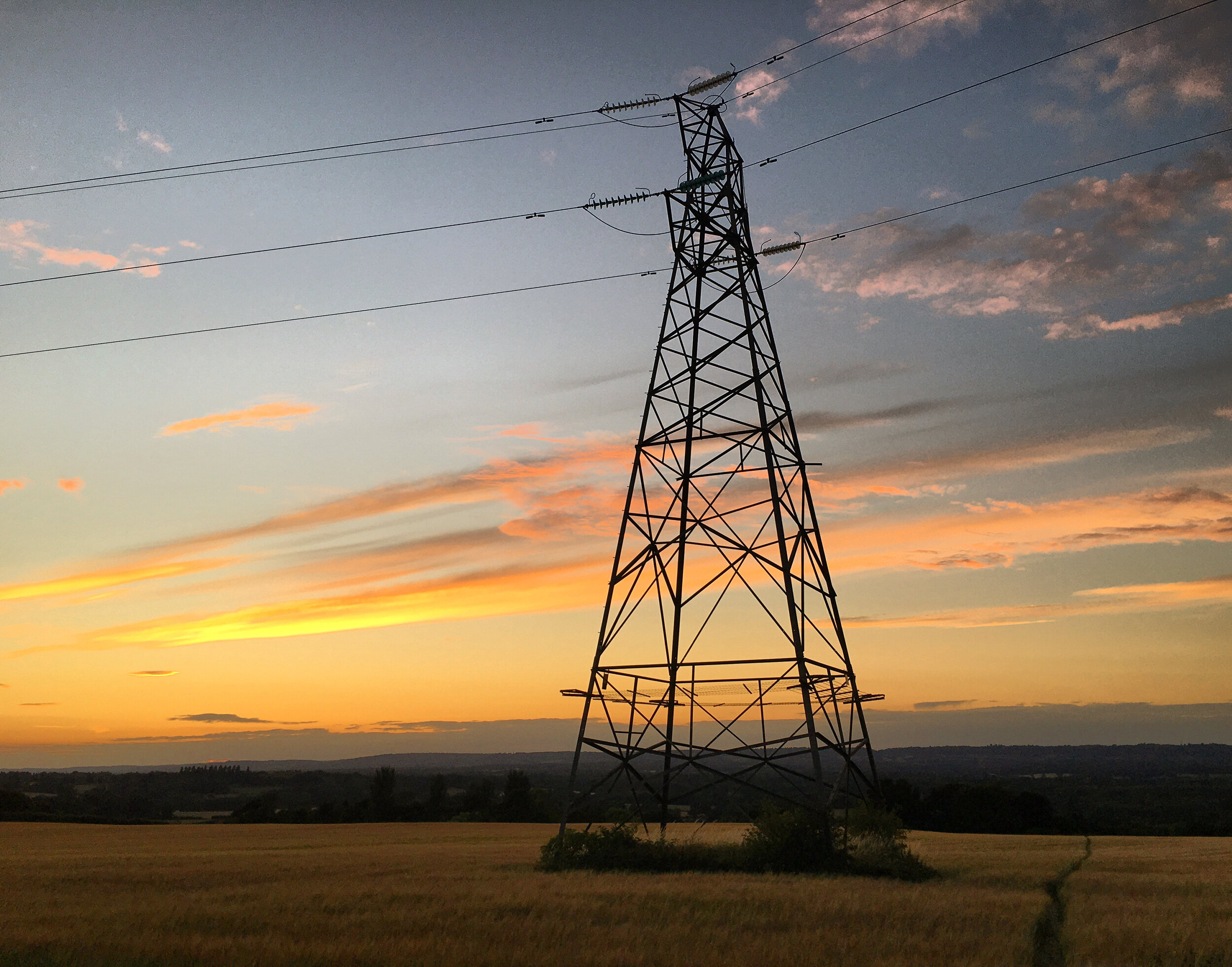
Up ahead in the distance you will see an electric pylon come into view. Once you reach the pylon the field begins to plateau.
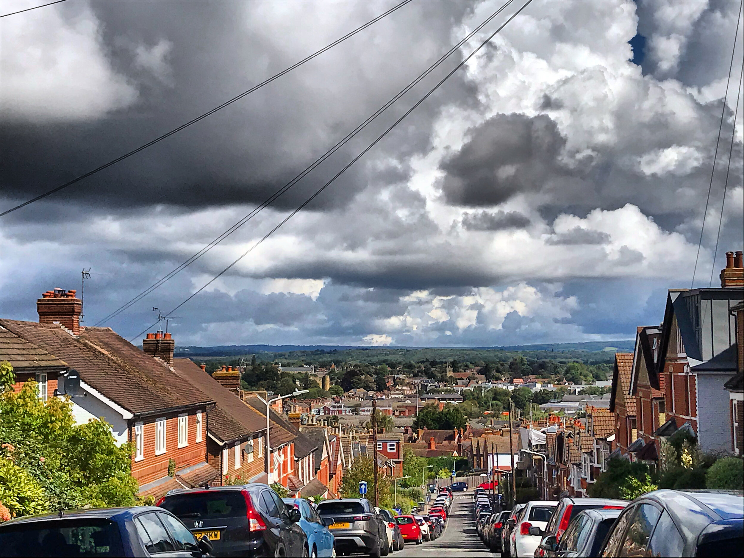
Take a minute to catch your breath and enjoy the view. Tonbridge is just out of sight but you can clearly see St Mary's church in Leigh, and the A21 snaking its way across the valley. The pictures I have taken don't do this view justice and with the best will in the world, my words can't illustrate this without resorting to hyperbole, so simply put; this view is breathtaking.
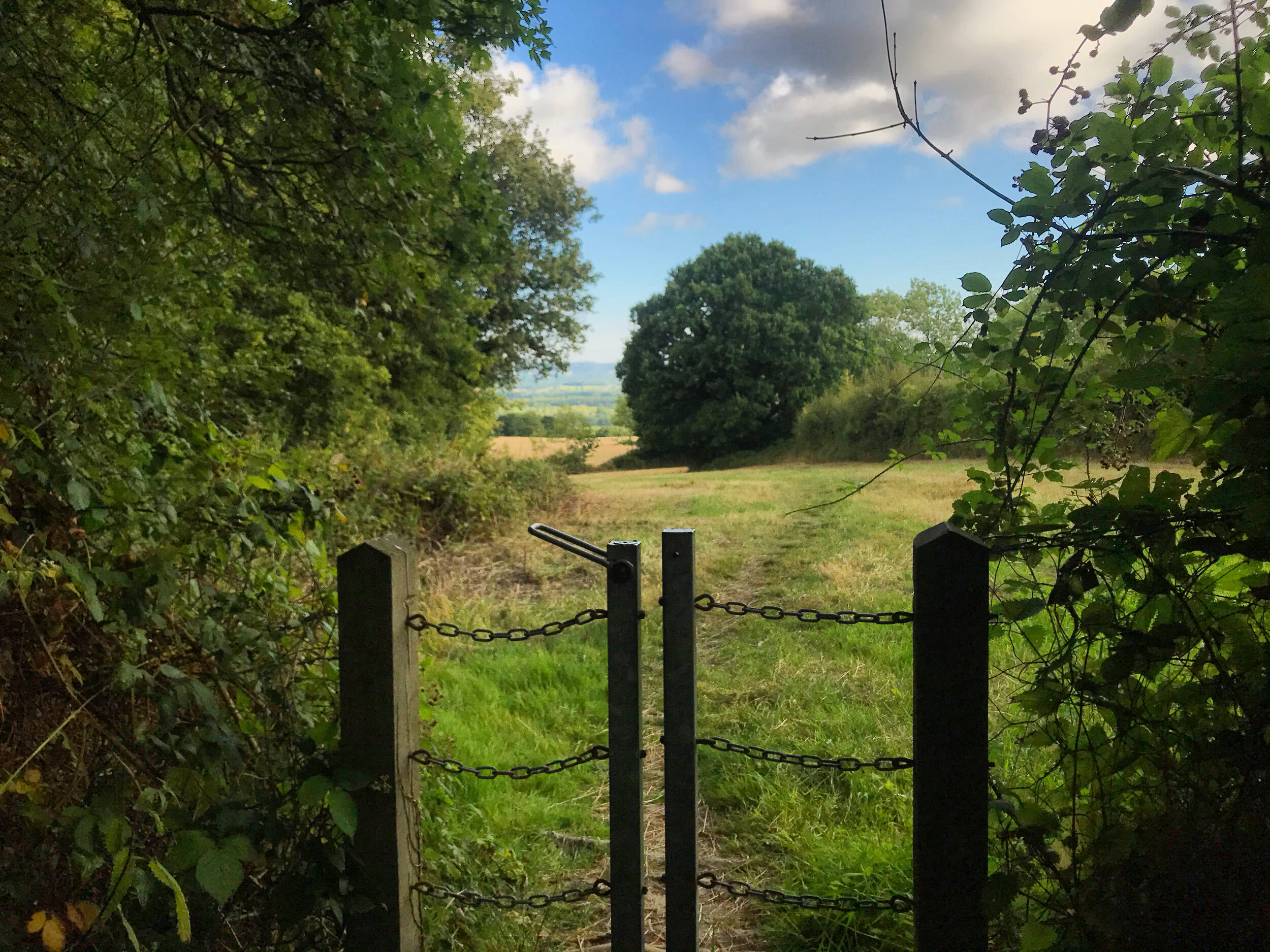
Continue on uphill, taking the path to the right of the trees, before veering off and passing through a chain gate.

Ascending the ridge, Bidborough
Stoop under the branches and then proceed upward, before walking through another chain gate and then through some trees.
After emerging into another clearing, walk straight on and then pass through a final chain gate, before continuing onward through a little wooden gate.
You’ll need one more push as you follow the road with care for 260 metres as it snakes it’s way uphill past Broadhill farm. It's at roughly this point in the walk that the altitude nudges into three figures for the first time.
At the top of the road you will be greeted by the welcome sight of Alf’s Corner, a pair of benches marking this scenic corner of Bidborough Ridge. I'm not sure if Alf was a walker or simply enjoyed the view here, but either way you'll be grateful for the rest at this point.

Alf’s Corner, Bidborough Ridge
Even more welcome is the Kentish Hare, across the road and to your left. This acclaimed gastropub is owned by local lads, Chris and James Tanner.
The brothers' journey into the catering industry can be traced back to their studies down the hill at West Kent College. After finishing their studies they went on to build up their reputations in some of the best kitchens in the world - including those of the Roux brothers.
In 1999 the brothers teamed up and went on to open their first restaurant in Plymouth, gaining critical acclaim and with it a place on the burgeoning celebrity chef scene.

The Kentish Hare, Bidborough
The pair returned to Kent in 2014 and using their proven recipe for success, transformed 'The Hare and Hounds' into 'The Kentish Hare'. The pub/restaurant remains popular to date and continues to maintain the Tanners ethos of serving fresh, locally sourced food that reflects the changing seasons.
If you plan to stop mid-walk then they also have a very good bar and attractive garden, where you can enjoy a few drinks and a more casual menu. You can check their opening times and menu here.
When ready to continue your walk, turn left and walk down High Street until you come to St Lawrence Church.

WW2 remembrance plaques at St Lawrence Church, Bidborough
Pass through the lychgate and you will see two simple memorial plaques dedicated to the servicemen that lost their lives in the two world wars.
These arched gates were traditionally used to provide shelter for the coffin and the mourners bringing it for burial. They became more common in 1549, when after the reformation, the book of common prayer dictated that the priest was required to meet the corpse at the churchyard entrance. Lych comes from the old English word ‘Lich’ meaning corpse. You can read more about this here.
One more climb awaits, as you ascend up through the church yard. At the top of this hill upon a hill, you will be rewarded with yet another dramatic view as you peek over the rooftops to Speldhurst and beyond.

Looking across to Speldhurst, from Bidborough
These two villages once shared more than just this special view; in olden days they also used to share their respective mills. Speldhurst had a watermill that would be used as a backup for Bidborough when the wind failed to blow.
If you look North West you will see the wooden cap and white tower of Four Winds windmill, peeping over the tree line. Bidborough's mill has sat on the ridge since the 1700's, but no one is sure if this was the original build or an 1858 replacement. Its milling days ground to a halt back in 1900 after a great storm struck two of it's sails, forcing it out of action.
The remaining sails were removed shortly after this and then its wooden cap was lost during another storm forty years later. The wooden cap you see sitting on top of the mill today was only added in 2006, presumably as a sweetener for the tower's development into housing. It looks authentic though and even without its sails it looks less like a lighthouse now!

Four Winds Windmill, peeping above the treeline.
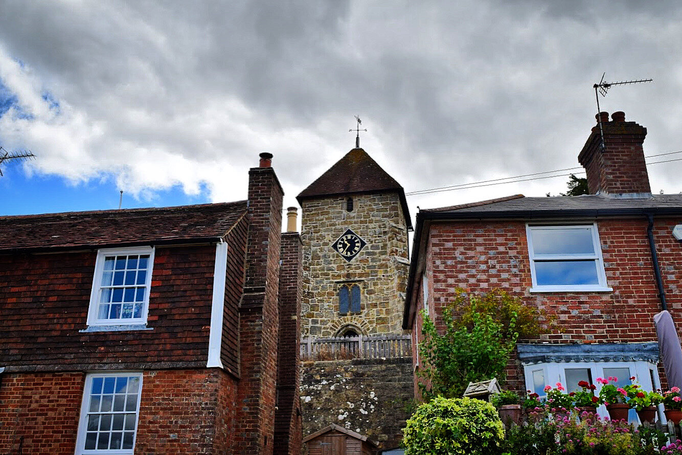
With all these views it's easy to get distracted, but let's talk about the church for a minute.
Parts of St Lawrence date back to the 10th century, when it was built by the Normans as a chapel of ease for St Mary's in Leigh.
Prior to its construction the locals faced an arduous 6 mile round hike, up and down the ridge and across the floodplain. Taking pity on these pilgrims, St Mary’s granted Bidborough its own place of worship on the basis that they paid the mother church four shillings each St Laurence day. The church was built using stone quarried from the stone it sits and Bidborough became a parish in it's own right. A priest was installed and St Lawrence Church was born.

St Lawrence Church Tower, Bidborough
Just over 800 years later and it’s still standing strong, although there has been many additions and extensions along the way. Some of these were carried out by famed Victiorian architect Ewan Christian, who you may remember from our 'Tales from the shire' walk.
Surprisingly the church is not the oldest thing in the church yard though. Look to your left and you will see an ancient yew tree, its branches entwined amongst the graves. This tree is estimated to be over 1000 years old and was most likely planted by the Normans when they built the original chapel.

The ancient yew at St Lawrence, Bidborough
Pass round the side of the church and under another yew tree - this one is slightly younger, estimated at around 800 years old, making it a similar age to the church. Yew trees are often found in old churchyards as their poisonous bark and berries were used to deter commoners from grazing their cattle on the sacred land.
Walk down the steps and out through the South lychgate, before turning left and walking past Rock Cottage. Like the church, this house was built from the same Kentish sandstone that it sits on. If you look back uphill towards the church you will see where the rock was quarried from.

Rock Cottage, Bidborough
Continue past the school and then follow the lane down past the recreation grounds and allotments, then follow the footpath down the alleyway. Walk through the wooden gate and cross over the little bridge and you will find yourself in Brookhurst field. This pretty meadow is better known locally as the "Bomb crater" field, owing to the conspicuous dent which you will see shortly.
Take the path up through the centre of the field and you will see the 'crater' to your left. Despite local myths about stray WW2 bombs, the crater was actually dug out to provide material for a dam at the nearby lake.

‘Bomb Crater' field, Bidborough
The benches at the top offer a good view of St Lawrence and a place to picnic if you have not eaten at the Kentish Hare.
Pass through the metal kissing gate and then continue through Birch woods as the scenery changes once more. The woods take their name from the prolific amount of Silver Birch trees here.When you reach the cross roads in the path, turn left, walk downhill and continue past the large lake. Tucked away in the woods and carpeted with lily pads it makes for a curious sight, especially with its little Duck House.

Birch Wood Lake, Bidborough
Follow the path uphill through the woods and then past a large wooden gate as you re-enter suburban Bidborough.
Cross over St Lawrence Avenue and then continue into the alleyway, walking between the large hedges.

Birch Wood, Bidborough
When the path meets a junction turn right and follow this until you find yourself at Bidborough Ridge.
Cross over the road with care and then turn right as you follow the pavement along the top of the ridge. The taller amongst you will be able to enjoy the view over the hedge, but if you are under 5ft then don’t despair as the houses on the opposite side of the road are nearly as jaw dropping!

The view from Bidborough Ridge
Continue past the view point for approximately 350 metres and you will reach a footpath marker. Turn left through the hedge and follow the path downhill through Beechy Toll. This is quite steep and can get slippery when muddy, so do take care.
Pass through the metal side gate and then drink in the view as the trees give way to fields and Tonbridge comes into sight. You could spend hours here, scanning the landscape and picking out the town's landmarks laid out before you.

Descending Beechy Toll, near Bidborough
Follow the wide grassy path downhill, pausing to pay your respects to Dasha, Bertie, Percy and Wilson. The first time I walked up this hill I was worried that | might end up with a plaque of my own on this tree!
Continue down to the field until it begins to curve round, then you will see the path turn off to the left through the gap in the hedge.

The memorial tree at Beechy Toll, Bidborough
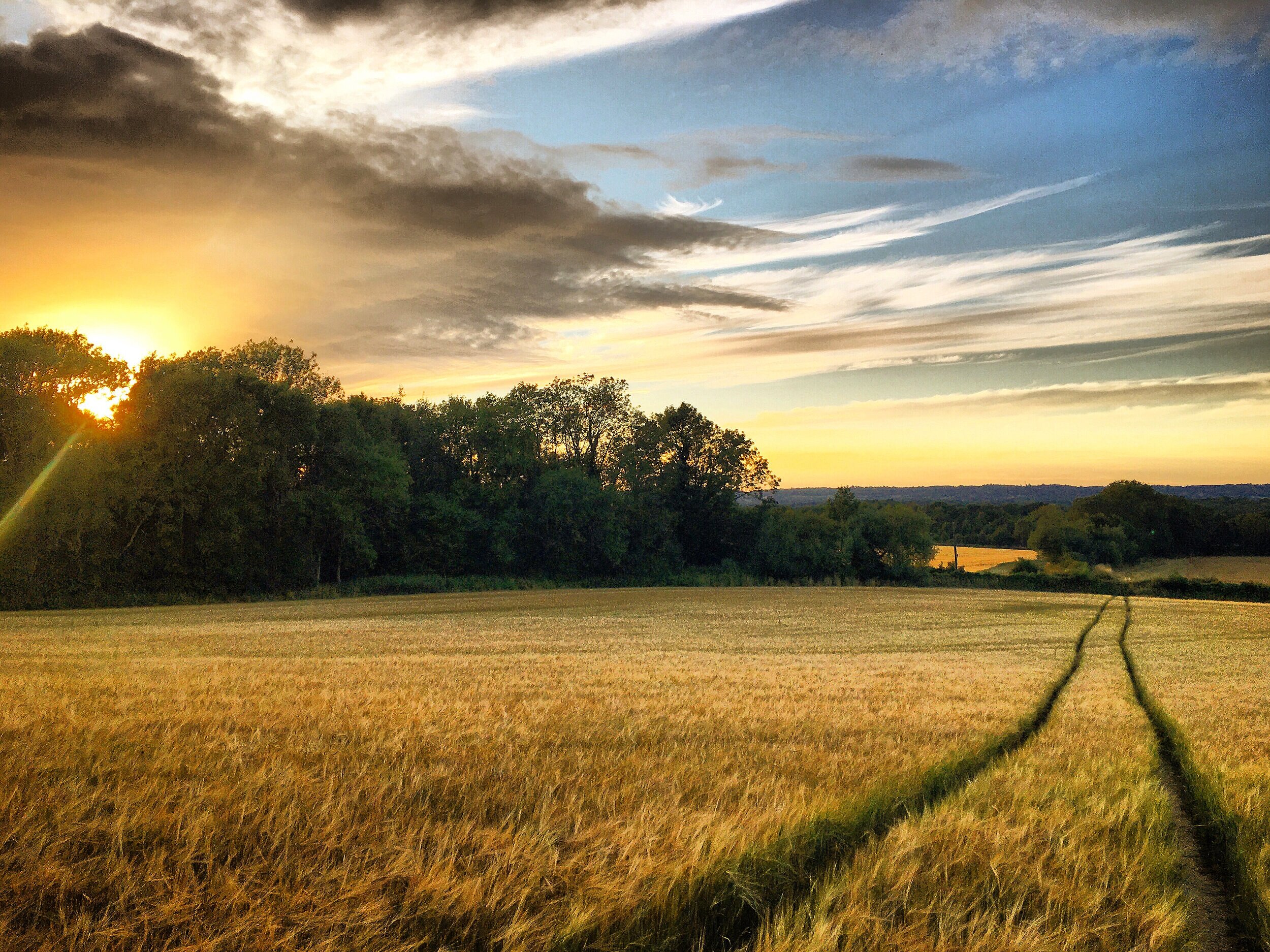
Walk through the hedge into a second field and then follow the trees until you see a path on your left, cutting across the field of barley. Once you reach the bottom you will come to a gap in the hedge which takes you onto Upper Haysden Lane.
Cross the road with care and you will see another gap in the hedge by the layby. Walk through this and across the ditch before continuing straight on.
At the end of the field turn left and cross the little bridge and then turn right under Manor Farm subway. This shiny new passageway was installed in early 2020, bringing the A21 to a standstill for 10 days. I would say this walk is just about worth the biblical traffic jams around Tonbridge that the road closure caused!

Manor Farm Subway, Manor Farm
Walk on through the blackberry bushes and then follow the path round and across the lawn at Manor Farm oasts.
Go through the large gate and then walk down the lane past the stately Haysden House, followed by a row of cottages. This little hamlet is Lower Haysden, its church and pub have long closed but if you look carefully you can see evidence of both.

Oak House And Acorn House - once the Royal Oak Pub
To your right you will see the Old Royal Oak pub, an old boozer now converted into two smart Houses. Etched into the glass of its entrance porch you will see the markings for the public bar.
Straight ahead you will see the beautifully restored Mission church - now an innovative new house. For many years this old tin church lay ruined and overgrown, so it's great to see it brought back to life. You can currently see the difference by looking at this Google Street View image. Tonbridge is lucky enough to have three of these quirky old tin churches - two of which are still used for worship. You can view both of these and learn more about tin tabernacles on our 'Darling Buds' walk.

The Old Mission Church, Haysden
Continue straight on down Lower Haysden and then turn right through the large wooden gate before walking down the bridle route as you join the outskirts of Haysden country park.
At the end of this path turn left and continue straight ahead as you walk along the bed of James Christie’s failed canal - The Straight Mile. If you do not already know the story behind this then you may wish to read more about this here.

Walking the dry ‘Straight Mile’ canal bed
The path emerges at the base of the flood barrier embankment. It's much steeper here, accounting for the proximity to the river. Turn left, walking through the leafy tunnel of trees and then continue until you reach Lower Haysden road once more.
Turn right and walk under the flyover where you will find yourself back at Haysden water car park, marking the end of your walk.
Acknowledgements
Whilst researching the Punnets and the Quarry Hill development I found some useful information in this book.
Thank you also to my contact who kept me sane whilst trying to figure out the mystery of Haysden and Hayesden - I went with the cartographers error!